Pretty happy with the hat Charlie found me in the Atiwhakatu.
As is usual, plans were oscillating during the week as the weather forecast moved about; a tops trip, a valley trip, or stay home and drink beer? The rain forecast didn't look to bad for a main range trip, but the wind looked breezy on Sunday and Monday.
As we had the three days of Labour Day weekend we were hopeful for a decent jaunt in the Tararua so Nick and Missy had agreed to meet us at Jumbo later on Friday evening for an early Saturday getaway. Nic and I were away from Holdsworth carpark by 1600 hrs so were enjoying a Pita Pit dinner and Wairarapa views on the Jumbo deck just after 1900 hrs.
The hut was chocka - including 10 from a group of 20 from the North Shore Tramping Club (the other ten bedding down at Powell Hut). That's keenness, driving all the way to Masterton for a weekend in the Tararua, maybe a reflection of the history that the mountain range has.
The best laid schemes o' mice an' men - Nick and Missy ended up caught in a traffic jam and didn't arrive at Mt Holdsworth carpark until much later than planned so only made it to Atiwhakatu on Friday evening, disturbing a deer on the walk in.
An early start straight up Raingauge Spur had them at Jumbo at a reasonable hour, and gave Nic and I a leisurely start to the morning. It also gave us all some time to consider the weather situation.
A plan was hatched to head back down into the Atiwhakatu via the northern track and over the Barton Track to Mitre Flats for Saturday evening.
The track heads east from Jumbo Hut with great views north to Baldy.
And east over the Wairarapa plains.
Once off the spur we stopped for lunch at the Atiwhakatu steam before the short walk north to the bridge and climb to the Baldy Track turnoff.
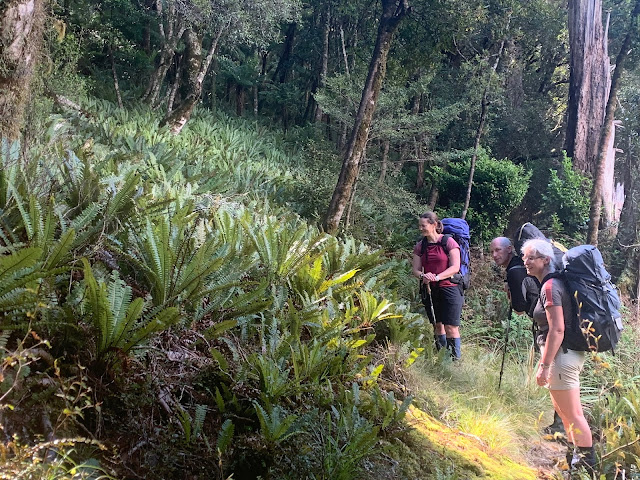
The fernery.
As expected for a long weekend Mitre Flats Hut was full, so by mid afternoon we had tents pitched and were enjoying some down time by the river. You gotta love those 1980's purple fleece pants!
Due to the change in plans we had a day up our sleeve and with bad weather on the tops we thought Mid King Biv would be a good target for Sunday. As Nicola had sprained an ankle on Saturday she opted for a day's cross-stitch at Mitre Flats.
Our day started with a wander up the true left (TL) of South Mitre Stream.
After around half an hour, a crossing to the TR, and passing of two creeks, a prominent spur is gained. This well walked but unmarked track heads NW to 600m then West to the bivvy at 1,140m.
We left the hut in fairly good weather although the wind up higher was obvious and a little liquid was floating about.
By the time we were at 1,000m things had gotten a tad worse; it was colder, windier and the rain had set in. We overshot the sidle around to the biv and climbed to over 1,200m and onto the tops before turning around and spending a little more time looking for the sidle around to the biv. This wasn't evident and as we were all drenched, cold and keen on lunch we quickly made the decision to drop lower and find a spot out of the weather to warm up and eat.
We enjoyed a 'learning moment' whilst in the mist. Having recently lost my Garmin GPS we were using phone mapping Apps. Our phones touch screens did not work at all well in the rain. Make sure you have alternatives when in bad weather.
Enjoying the warmth of a lower altitude. . .
Once back at South Mitre Stream we decided to follow the TR back down to the bridge, and found a good track for most parts. Just shy of the bridge things got a little sketchy and Missy decided to spice things up a bit by slipping and calling for help.
Husband Nick, always the helpful bugger, decided a photo opportunity had presented itself, so with a "I'll be with you shortly luv" proceeded to document Missy's predicament before offering a hand.
We were back at Mitre Flats Hut around 1500 hrs but decided another hut night trumped a walk out today.
The walk out from Mitre Flats on Monday took a little over 3.5 hours to the road end, and is a fairly easy stroll. A quick stop was in order, to paddle the Mitre Waka.
As our vehicles were at Mt Holdsworth we had to wander along the Upper Waingawa Road for a km or two until we could find a crossing of the Waingawa onto Blakes Road and home.
Regular tramping buddies, Missy (Navy Commander, Nav girl and much much more).


